MADAGASCAR TRAVEL CENTRE
  • Home
  • Madagascar
    • Visa Information
  • When to travel
  • Destinations
    • Anja Reserve
    • Vanilla Coast
    • National Parks >
      • Andasibe-Mantadia Park
      • Ankarana Special Reserve
      • Isalo National Park
      • Marojejy National Park
      • Masoala National Park
      • Ranomafana National Park
      • Tsingy de Bermaraha
    • Beaches & Resorts
  • Itineraries
    • Baobabs & Beaches
    • Southern Route
    • The North
  • Group Tours
  • Why us ?
  • Contact
  • Blog
Andasibe-Mantadia National Park
Picture
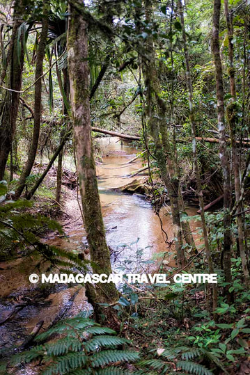
Mantadia Primary Forests
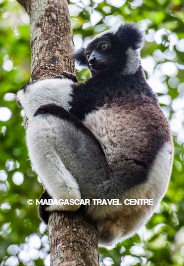
Picture
Indri or Babakoto

Andasibe-Mantadia National Park has a total area of 154 km² divided into two zones.

The southern area is called Réserve Spéciale d'Analamazaotra, although the old French name "Perinet" is still very commonly used.
As it is next to Andasibe village it is now referred to as Andasibe National Park.

North of Andasibe is the much larger Parc National de Mantadia.

The park was created in 1989, and is very popular due to its proximity to Antananarivo and the good roads that join the two.


Features of Andasibe-Mantadia:  Primary forests, endemic flora and fauna, hiking and a good population of the largest of lemurs, the Indri, which has a haunting call.
One of the best locations to see Indri in Madagascar.

Time to Visit: Rainy throughout the year, with the best times being May - October

Access: via Antananarivo or Toamasina by sealed road
Picture
Picture
Picture
Contact us........
  • Home
  • Madagascar
    • Visa Information
  • When to travel
  • Destinations
    • Anja Reserve
    • Vanilla Coast
    • National Parks >
      • Andasibe-Mantadia Park
      • Ankarana Special Reserve
      • Isalo National Park
      • Marojejy National Park
      • Masoala National Park
      • Ranomafana National Park
      • Tsingy de Bermaraha
    • Beaches & Resorts
  • Itineraries
    • Baobabs & Beaches
    • Southern Route
    • The North
  • Group Tours
  • Why us ?
  • Contact
  • Blog